The provinces (or governorates) that existed until the French Revolution were historically grown entities that had often developed from former fiefdoms of the French crown, historical counties and duchies, often existed for hundreds of years and had preserved regional characteristics (cultural peculiarities and regional languages). Such phenomena were naturally undesirable to the French Revolution, and in the context of its bloody and violent egalitarianism, all regional references were eradicated. Shortly after the Revolution, the provinces were dissolved and France was divided into many small départements, which were to be approximately the same size and have the same status, controlled by prefects of the central administration in Paris. The departments were named after rivers or mountains so as not to use the names of any of the old provinces. However, it was not possible to sever the ties between the inhabitants of France and their respective historically grown regions, so that in 1960 regions were created again. There can hardly be said to be any real autonomy. The regions are only supposed to promote the economic, social, health, cultural and scientific development of the region, keep an eye on housing and living conditions, and provide support in some areas, e.g. urban development policy, urban regeneration, regional planning, preservation of regional identity and promotion of regional languages. When the regions were formed, departments located in a particular historical province were administratively grouped together into a region that often had the same historical name. The resulting entities only roughly corresponded to the boundaries of historical provinces. In strictly centralised France, however, any form of responsible regionalism is avoided. The regions do not even have their own seals with which to mark their own legally binding decisions, because there are no plans to introduce such a thing. Therefore, anything to do with coats of arms or flags is completely irrelevant. The logos of the regions are used generally, sometimes with the colours reversed and placed arbitrarily on flags or banners. There are no rules, as they are not official symbols. The logos and flags of the regions therefore often look like company logos: Unloving, unhistorical, technocratic and modernistic. That is why most of these regions have a kind of unofficial heraldic flag, which is intended to recall historical heraldic models. However, these are merely decorative in nature and are not a symbol of sovereign functions. The regions created in 1960 were even called into question in 2014, and a territorial reform was decided – centrally from Paris – which reduced the number of regions by almost half through mergers. The regions and their institutions were not even consulted on this matter.
Wikipedia link to the regions of France: click here
FOTW link to the regions of France: click here
English name, or translated: Auvergne-Rhone-Alps
Seat of the Regional Prefect: Lyon, consisting of 13 Departments, area: 27.334,00 sq.mi., population: 8.114.400 (2021)
English name, or translated: Burgundy-Free County
Seat of the Regional Prefect: Dijon, consisting of 8 Departments, area: 18.518,58 sq.mi., population: 2.800.200 (2021)
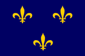
English name, or translated: Brittany
Seat of the Regional Prefect: Rennes, consisting of 4 Departments, area: 10.582 sq.mi., population: 3.394.600 (2021), more information about the historical Brittany ← click here
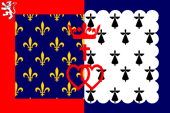
English name, or translated: Centre-Loire Valley
Seat of the Regional Prefect: Orléans, consisting of 6 Departments, area: 15.239 sq.mi., population: 2.573.300 (2021)
English name, or translated: Greater East
Seat of the Regional Prefect: Straßburg (Strasbourg), consisting of 10 Departments, area: 22.280 sq.mi., population: 5.561.300 (2021)
English name, or translated: Upper France, Northern France
Seat of the Regional Prefect: Lille, consisting of 5 Departments, area: 12.356 sq.mi., population: 5.995.300 (2021)
English name, or translated: Greater Paris Region, Central France, Francia
Seat of the Regional Prefect: Paris, consisting of 8 Departments, area: 4.658 sq.mi., population: 12.317.300 (2021), more information about the historical Greater Paris Region (Francia) ← click here
English name, or translated: Corsica
Seat of the "Collectivité territoriale unique": Ajaccio, consisting of 2 Departments, area: 3.382 sq.mi., population: 347.600 (2021), more information about the historical Corsica ← click here
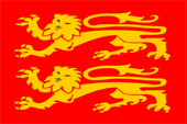
English name, or translated: Normandy
Seat of the Regional Prefect: Rouen, consisting of 5 Departments, area: 11.640,6 sq.mi., population: 3.328.000 (2021), more information about the historical Normandy ← click here
English name, or translated: New Aquitaine
Seat of the Regional Prefect: Bordeaux, consisting of 12 Departments, area: 32.721,6 sq.mi., population: 6.069.400 (2021), more information about the historical Aquitaine ← click here
English name, or translated: Occitania
Seat of the Regional Prefect: Toulouse, consisting of 13 Departments, area: 28.344,5 sq.mi., population: 6.022.200 (2021)
English name, or translated: Countries of the Loire
Seat of the Regional Prefect: Nantes, consisting of 5 Departments, area: 12.495,5 sq.mi., population: 3.854.000 (2021)
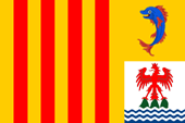
English name, or translated: Provence-Alps-French Riviera (Southern Region)
Seat of the Regional Prefect: Marseille, consisting of 6 Departments, area: 12.235 sq.mi., population: 5.127.800 (2021)